Morwenstow to Bude:
Walk the South West Coast Path
Stunning scenery on this amazing route
Distance: 7.5 miles
Severity: Severe
Time it took us: 4hrs 40mins
Steps: 19,352

A climb back up the other side and across more lush grassland as behind the giant satellite dishes begin to shrink as they disappear into the distance.
Reaching the opening to Sandymouth Beach, popular with surfers and rock-poolers and well worth a look whilst you’re there. Here you’ll also find toilet and café facilities if you fancy a snack and short break.
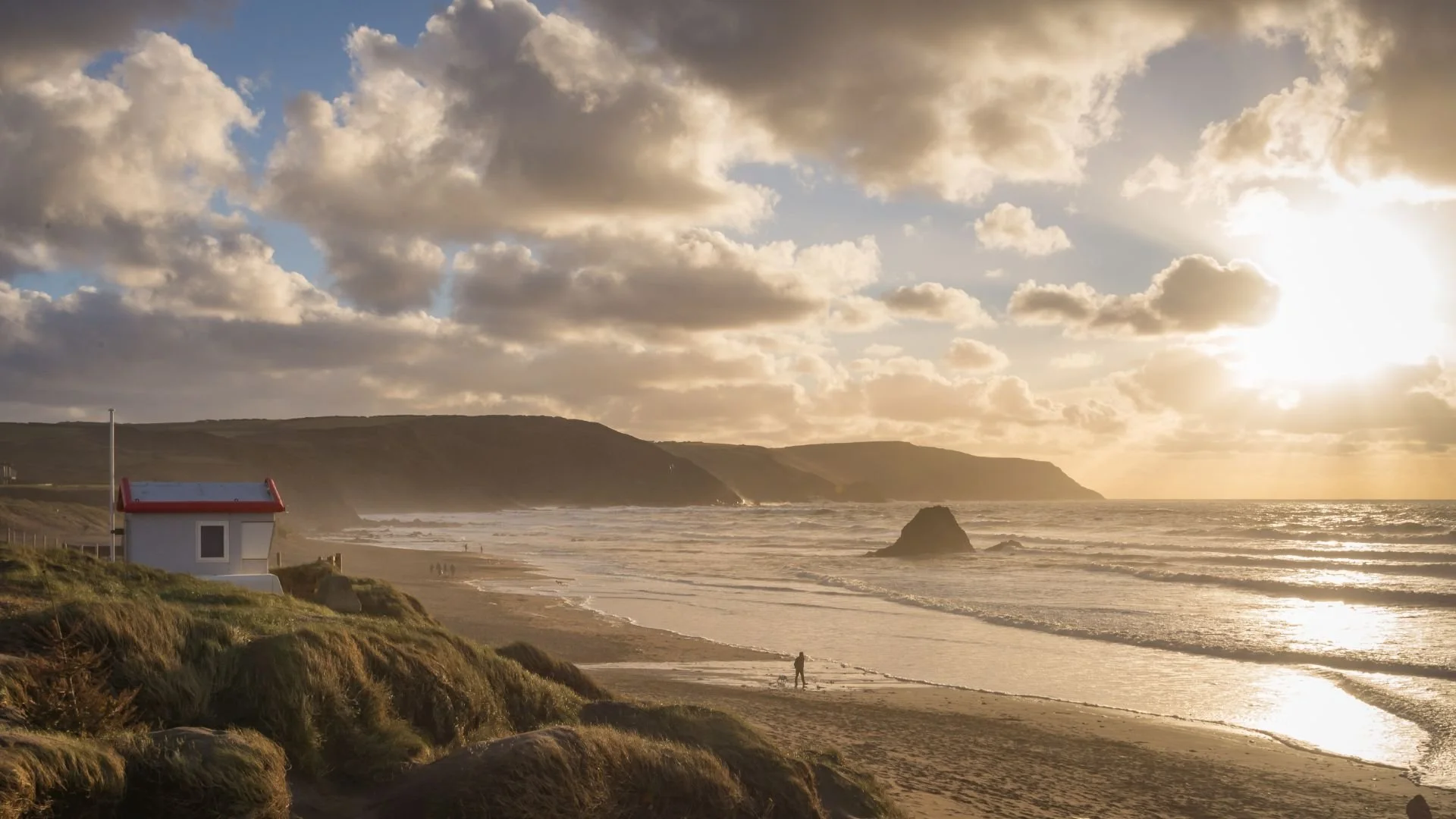
The going now eases at last, but the views don’t. Next it is down more steps to the pebbly beach of Northcott Mouth, across Maer Cliff before the Path arrives at Crooklets Beach in Bude and its colourful beach huts.
This stretch took us 4hrs 40 minutes and I can highly recommend hiking sticks. Don’t forget to take a packed lunch and plenty of water to fuel up along the way, you’ll need it.
If you enjoyed this walk, you should try Hartland Quay to Morwenstow. It's a stunner!
This breath-taking and dramatic stretch of coastline has some seriously arduous climbs and descents, but the rewards are worth the effort. The South West Coast Path guidebook actually suggests Hartland Quay to Bude, but as that is considered to be one of the toughest sections of the entire 630-mile trail, we decided to split it in two. It was a good decision and gave us more time to take in the spectacular cliff-top views of stunning Cornish coastline which stretches out for miles and miles into the distance.
We tackled this stretch on an extremely windy late November day which brought its own challenges but failed to put us off.
The walk starts out from behind The Bush Inn, a quaint and cosy 13th Century pub at Crosstown, through woodland to eventually
re-join The Path. A steep climb upwards out of the valley and the winds were getting stronger and stronger, so much so that at the top we got showered by the spray of a waterfall which was blowing backwards up the cliff face.

It’s not long before the giant satellite dishes of GCHQ (Government Communications Headquarters) appear in the distance.
But between us was another steep descent into Stanbury Mouth and back out up the other side.
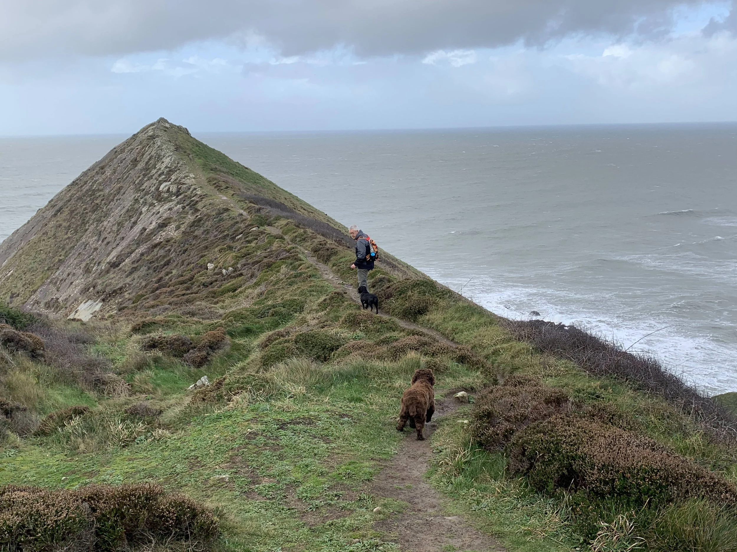
Taking a sharp right after the dishes (which could easily have been missed) it’s out towards the cliff edge of Lower Sharpnose Point where the miles of jutting headlands stretch out before us in the distance. The view is remarkable and has to be experienced
first-hand as our photos don’t entirely do it justice.
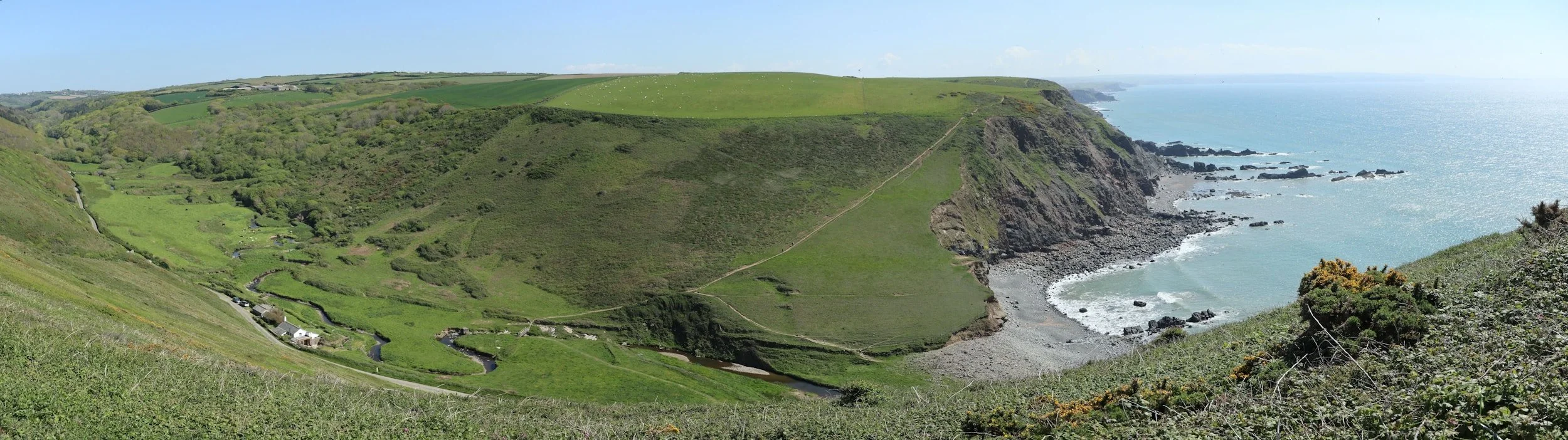
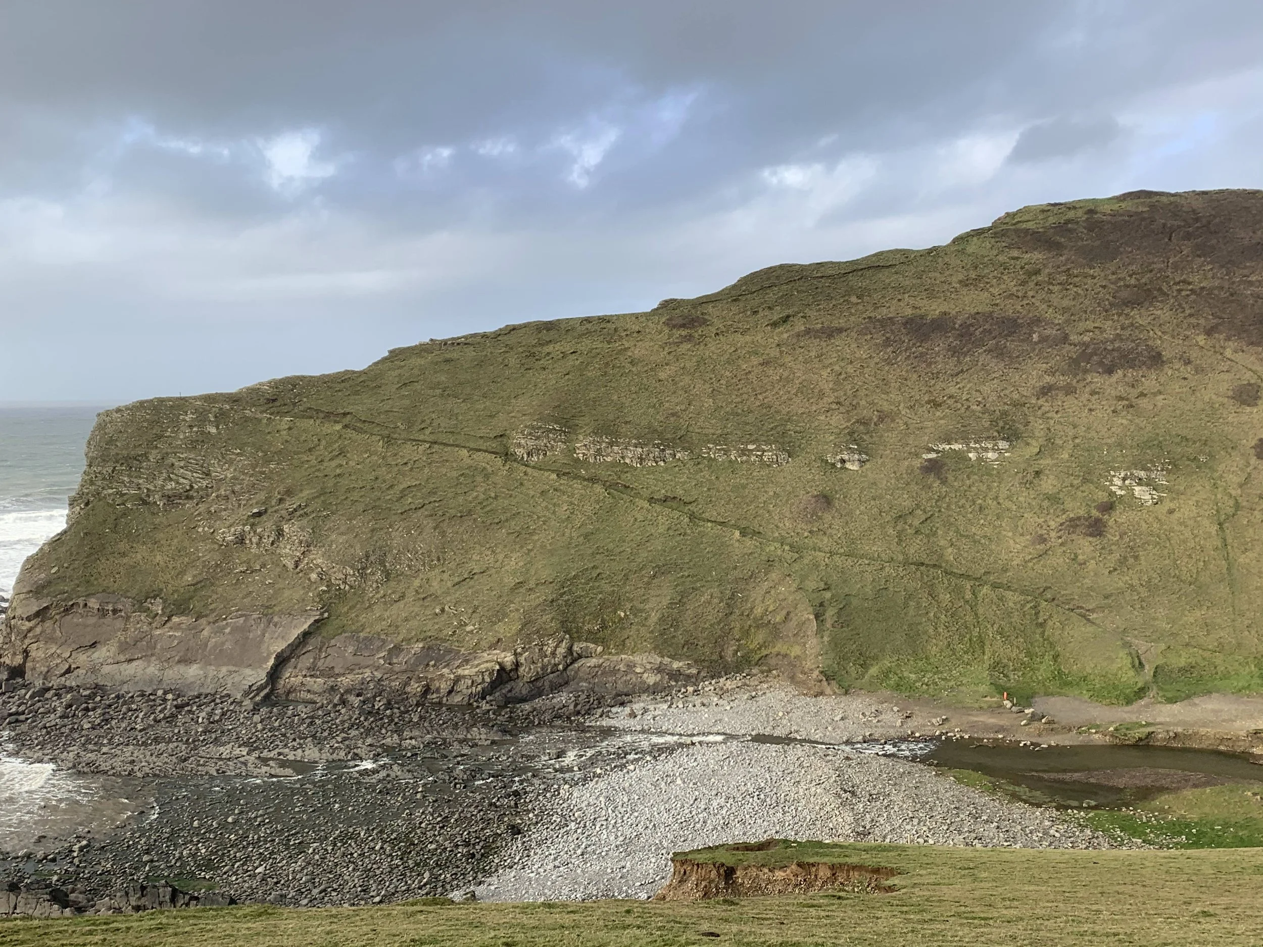
Continuing across grassland, next came a knee-trembling steep cliff edge descent down Steeple Point to Duckpool at the mouth
of the Coombe Valley.